|
Evolution Sahara Humid Periods Jean Vaucher (Jan. 2021)
|
Geography and climate have always played important roles in the evolution and migration of Man. Sub-Saharan Africa with its temperate mixture of rain forest and savanna was the ideal crucible for successive species going from apes to walking hominins to our own Homo Sapiens. But, for all of recorded history, exit from the continent has been blocked by the Sahara, the world's largest arid desert which occupies a third of the continent and forms a 1,000 mile wide barrier all accross the north.
It is sometimes assumed that early hominins used the Nile corridor to reach the Middle East via the Sinai; but, although Nile water would later support agricultural communities, the total lack of rain meant that there was no vegetation or wildlife on the banks to sustain migrating hunter-gatherers. Similarly, the southern route, which entails crossing the Red Sea to Yemen during the Ice Age, would face a similar arid barrier, the Arabian Peninsula, after the crossing.
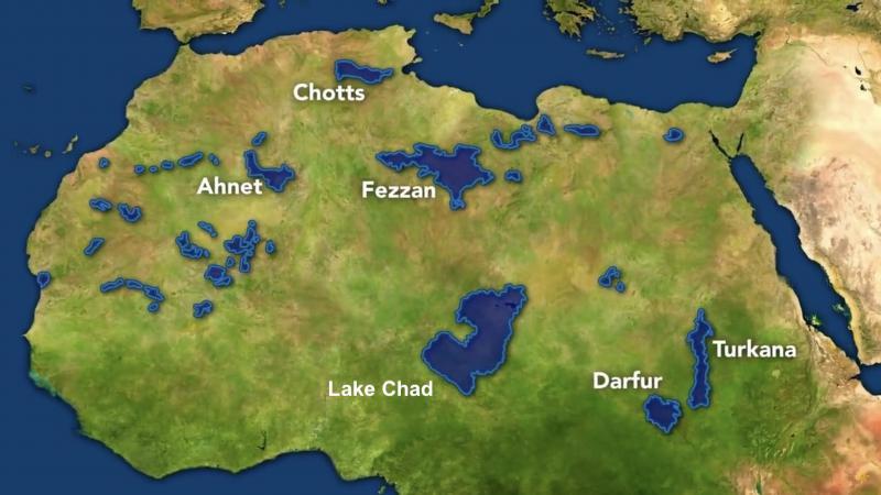
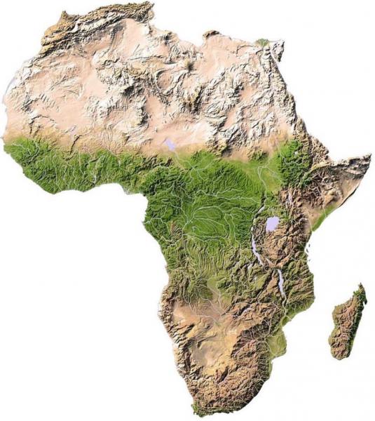
However, the Sahara was not always a barrier. Research and exploration has confirmed that the Sahara alternates between arid desert (below left) and humid (green) savanna with lakes (below right) in a 20,000 year cycle and that humid periods have recurred continuously throughout the time of human evolution.
The Sahara entered its last humid period 11,000 years ago, just after the last Ice Age. During that time, monsoon rain increased, huge lakes appeared and the whole area turned into savanna much like we find now in Kenya or Rwanda. Lake Chad, the biggest lake, was about the size of the current Caspian Sea - much bigger than all our Great Lakes put together. The last humid period lasted about 6,000 years, ending about the time of the first Pharaoh in Egypt.
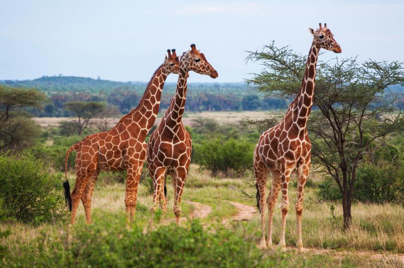
During its green periods, the Sahara was home to all the animals we associate with Africa: like giraffes, antelopes, rhinos and elephants as well as aquatic varieties: hippos and crocodiles. This lush environment allowed the early hunter-gatherers to leave the sub-Saharan crucible of emerging species and spread over the rest of the continent reaching the exit points to the rest of the world: the Sinai to the middle east and the Strait of Gibraltar for Europe.
Rock Art
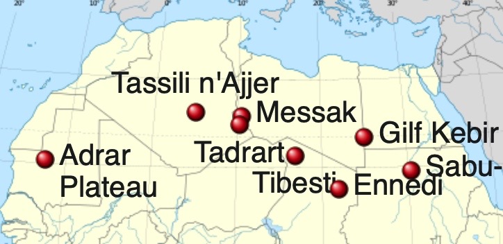
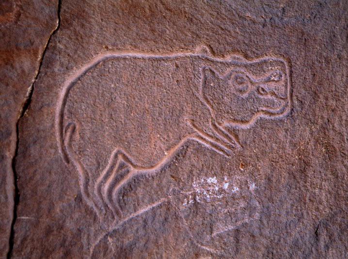
| Below, click on images to ZOOM! ; arrows to change; ESC to quit ! |




Why the Sahara turns Green
The position of the Earth with respect to the Sun has obvious effects on our daily life: the Earth's rotation causing alternation of night and day and the 23° tilt in our axis of rotation means that, for half a year, one hemisphere is more exposed to the sun and enjoys summer while the other is in winter. Six months later, the situation is reversed.However, nothing is fixed in astronomy. Every aspect of our orbital motion changes in long term cycles and the interplay can cause as much as a 25% difference in the amount of incoming solar radiation at some points on Earth. The changes, called Milankovitch cycles consider:
- Eccentricity, the shape of our orbit, varies from 0-5% in a 100,000 year cycle
- Tilt which oscillates 2% in a 41,000 year cycle
- Axis wobble moving from Polaris to Vega in a 26,000 year cycle
Cyclic phenomena like recurring Ice Ages and deserts turning green are due to these Milankovitch cycles. But the exact relationship is not obvious; it depends on geography.
Paradoxically, the Sahara turns green due to a slight increase temperature when northern summer coincides with perihelion, when earth is closest to the sun [Ref. EOS ]. This causes a modest increase in Monsoon rain which allows progressively more grasses to grow. At some point, this triggers a chain reaction because vegetation reduces evaporation allowing for more vegetation and the whole area suddenly gets covered in grass then trees. Eventually, excess water collects in lakes and grassland animals move in followed by people. Similarly, at the end of green periods, desert conditions also return abruptly.
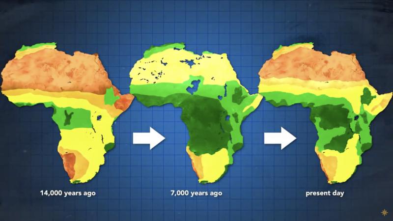
Research has shown the the Sahara alternates between desert and grassland in a 20,000 year cycle. The image below shows different points in the cycle. Brown is desert, yellow is savanna, green is forest and dark green is rain forest. Extreme aridity which was the case 14,000 years ago is shown at left. The middle shows the green period which started 11,000 years ago and lasted about 6,000 years later. The right shows our current situation with the return of the desert and, eventually, the extreme aridity shown at left.
The rapid end of the humid period, around 3,000 BCE, caused an exodus of people from the drying savanna into the Nile valley, and this coincides with the unification of Egypt under its first Pharaoh. The main difference between now and the next arid period shown at left will be the disappearance of rain forests.
Green Arabia
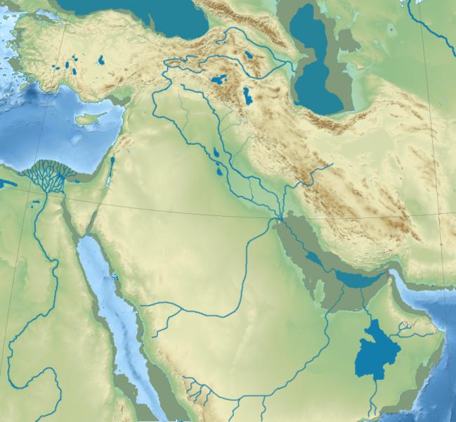
Geological and archeological surveys have confirmed that the Arabian Peninsula, like the Sahara, also underwent humid periods in the past [ Ref ]. There is evidence for ancient rivers and lakes in the currently arid interior. Furthermore, traces of prehistoric human presence: stone tools and rock art, have been discovered showing that hunter-gatherers thrived in the interior.
However, studies and data for the humid periods are not as abundant as for the Sahara. Artefacts are typical of the Old Stone Age (~ 1 Mya) whereas petroglyphs portray a time after the agricultural revolution (~ 8,000 BCE ). However, it is clear that migrations Out of Africa through Arabia likely happened.
The maps below illustrate the river systems that are thought to have existed at various in the past as well as potential migration routes out of Africa. Remember, Ice Ages also played a role: with sea levels about 100 m. lower than today, the Persian Gulf would have been completely dry and the Horn of Africa crossing to Yemen reduced to a dozen miles. [Note: click on maps and use arrows to see these routes ].
Arabian Refs:
- Rock Art of Saudi Arabia, Unesco
- Blue Arabia, Green Arabia: Human Dispersal Models, Springer Verlag.
Conclusions
1) Climate is inherently unstable. Apparently minimal changes in ambient conditions can trigger huge changes in the environment. For the Sahara, a bit more or less sun during summers can turn half a continent from desert to bountiful grazing land... and vice-versa.2) Although Africa was spared the extreme cold of Ice Ages; the fact that its forests - the natural habitat of apes and monkeys - shrink to almost nothing every 20,000 years was probably a major factor in the appearance of Homo species: bipedal apes well suited to roaming the savanna and exploring the world.
3) The final lesson is that geographic features which now appear as barriers to human migration may not always have been so in the past. For example:
- We know that the drop in sea levels during Ice Ages turned the 50 mile Bering Strait into a land bridge, allowing humans to migrate into the Americas
- The discovery of a periodically Green Sahara supports the idea that Hominins first reached Europe from North Africa by crossing the Straits of Gibraltar
- "Accepted prehistory" assumes that early humans (Erectus then Sapiens) reached China via a southern route through India but the Green Sahara effect opens the possibility of a northern corridor from central Asia along the "silk road": passable periodically due to climate cycles.
Sahara References
- Biogeography of the Sahara explains the peopling of the desert, Proc. NAS (2011)
- African humid period (Wikipedia)
- African Humid Periods Paced by Earth's Orbital Changes (Knowledge Project)
- Blue Arabia, Green Arabia: Examining Human Dispersal Models, Springer Verlag.
- Rift Valley Formation, Geology.com
Saharan Rock Art
- Saharan Rock Art, Wikipedia
- Green Sahara c. 8000 years ago, Carl Churchill
- Damn Research Site
- Seas of the Sahara (Deviant Art)
- Green Sahara c. 8000 years ago, Carl Churchill
Videos
- How Geography turned the Sahara Green (Wikipedia)
- When the Sahara was Green (Eons)
- Rock Art in the Green Sahara, YouTube

